Ruby Beach
Ruby Beach: Info and photos picturing this very photogenic beach in Olympic National Park, plus suggestions to enhance your visit.
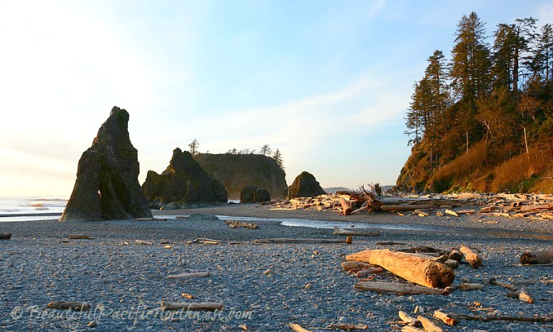
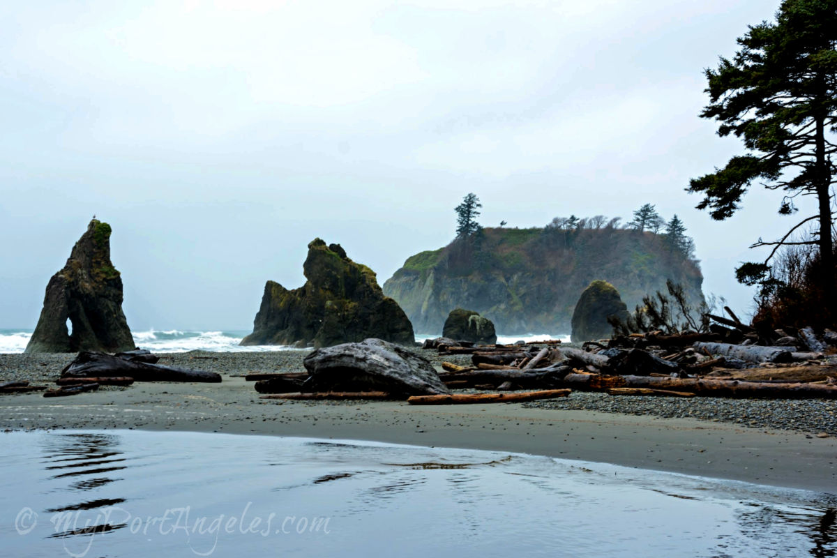
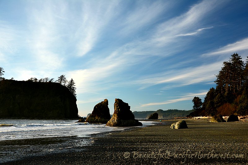
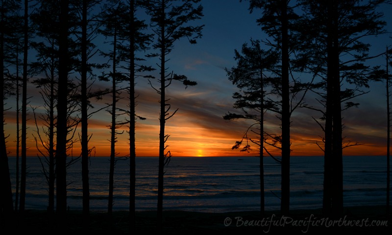
Wrap together into one scene a pebbly beach, dozens of drift logs, a creek running into the surf, and jagged sea stack monoliths, and then clothe it all in a temperate rain forest. Cap the scene with a fiery sunset, and you almost get the feel of Ruby Beach.
I say "almost," because nothing will surpass actually being there, inhaling the crisp briny air, basking in the tangible beauty, and hearing the calls of seagulls and bald eagles overhead.
Getting to Ruby Beach
Ruby Beach, Olympic National Park
Ruby Beach is located within the coastal region of Olympic National Park. It is the northernmost beach of the several Kalaloch Beach access points. See the Kalaloch Area Brochure.
Port Angeles is 83.5 miles (134.4 km) to the northeast of Ruby Beach. The drive is likely to take you about 1 hour 45 minutes. But if Port Angeles is not your starting point:
- Aberdeen WA is 80.7 miles (130 km) to the south southeast of Ruby Beach, a drive of about one hour 37 minutes.
- Forks WA, at just 27.1 miles (43.6 km) or 34 minutes drive, is the closest village to Ruby Beach.
A visit to Ruby Beach makes for an excellent day trip from the Seattle area. There are two ways to get there from Seattle:
- From the downtown Seattle ferry terminal, take the Bainbridge Ferry and travel through Port Angeles WA. This will take about 4 hours and 15 minutes to go 185 miles (298 km) due to the ferry sail, possible wait times, and lower speed limits.
- Take Interstate 5 South to Hwy 101 North through Tacoma and Olympia is a longer journey (166 miles or 267 km) but will take only about 3.5 hours.
Ruby Beach is one of several Olympic NP locations that are protected by the Park, yet can be accessed without passing by an entrance kiosk. There are no signs prohibiting entrance without a pass, and no machines where you can "pay here."
The parking lot for Ruby Beach is located directly off Hwy 101. Near the trailhead to the beach are simple restroom facilities.
The short trail down to the beach isn't much more than 500 feet (142 m). The walk to the beach is an easy one, but the beach entrance itself is choked by many large drift logs - you'll have to navigate over or around these (probably a little of both).

Take a Virtual Hike Along Ruby Beach!
Accompany the cameraman as he takes a 49-minute run/walk along Ruby Beach! Walk your treadmill or pedal your stationary bike while the scenic beauty refreshes your mind and heart. Enjoy!

Characteristics of Ruby Beach
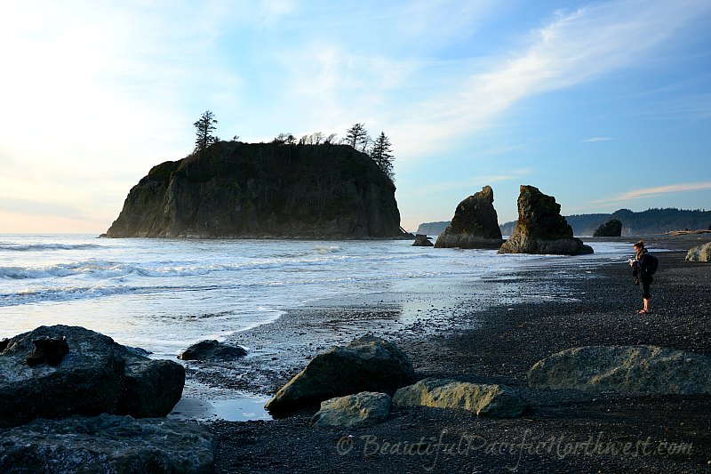
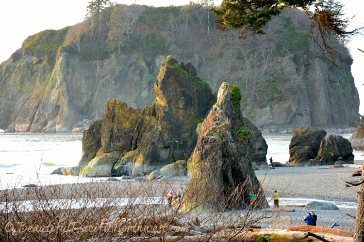
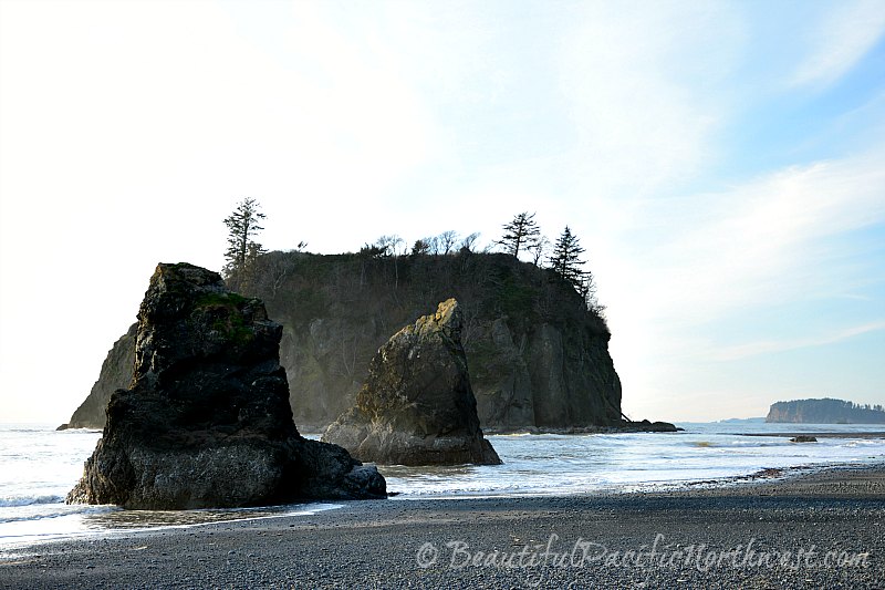
Several scenic sea stacks, some with holes through which to view or photograph, for example, the sunset. These contribute to the rugged feel of the shoreline and beach.
Abbey Island is directly offshore, and accessible at low tide. Why the name? Because the early settlers thought it looked like a church.
Find tide pools at low tide, filled with colorful creatures such as anemones, starfish, crabs, and more.
Cedar Creek cleaves the beach in half, contributing to the beauty of the area. This creek is easily fordable, either barefoot or with some sort of water-friendly footwear like flip-flops, crocs or rain boots.
Several miles of shoreline can be hiked, both to the north of Cedar Creek, and to the south. Hike north 3 miles to the mouth of the Hoh River (on Hoh tribal land), or hike south 1.5 miles to headland that can be rounded only during low tide.
Destruction Island and the Destruction Island Lighthouse, which are 4 miles offshore, are easily visible, so named to commemorate two Quinault tribal battles against Spanish and British military forces. Ruby Beach was the site of these bloody skirmishes.
Enhance Your Visit to Ruby Beach
Water Temperatures: Chilly! Check www.surf-forecast.com for today's water temperature. On average, water temperature peaks in mid-August in the range of 57 - 63 degrees F (14-17 C), and drops to its coldest point in early February in the range of 43 - 50 degrees F (6-10 C).
Even the air can be brisk. Expect to enjoy the beauty, the wildlife, seabirds, tidepools, and hiking, all within the sound of the pounding surf and cries of seagulls, rather than surfing, swimming, or sunbathing.
Bring footwear that can get wet. The beach is mostly small cobble, and if you're not used to being barefoot, it'll hurt - not to mention getting really cold feet if barefoot.
Be prepared to indulge the urge to shoot lots of photos, whether your instrument is a phone or fancy camera. Ruby Beach is THAT beautiful.
Carry a tide chart and a watch. If you're passionately interested in tide pools, it would be unfortunate to arrive at high tide. Additionally, if you have any interest in hiking south beyond the first headland, know that the headland is not passable except at low-tide. Plus, if you don't get out in time, it is possible to get stranded until the tides drop. Tide tables are available at Visitor Centers and coastal ranger stations. (There are also tide table apps for your phone.)
For intentional hiking, purchase a good topographical map. (We use and like this one.)
No camping is permitted on any of the Kalaloch Beaches, including Ruby Beach. However, Kalaloch Campground and South Beach Campground are nearby. See Olympic National Park Camping. Beach camping is permissible north of La Push, from Rialto Beach (north of Ellen Creek) to Shi Shi Beach (excluding tribal lands).
Pet regulations: Leashed pets are permitted on all Kalaloch Beaches, including Ruby Beach. They are also permitted in both campgrounds (leashed). They are not permitted on trails.
Do You Have Your Own Story or Photos of Ruby Beach?
Do you have a great story or exceptional photos about Ruby Beach in the Olympic National Park? Share it! (We're happy to ensure professional and amateur photographers get credit for their work! We can do this if you leave us your name and online website or FB page info.)
